Dr. Lucia Seebach
seit Juli 2013
Wissenschaftliche Mitarbeiterin - FVA, Abteilung Waldnaturschutz
- Wissenschaftliche Betreuung von Waldschutzgebieten
- Raumanalyse von Priortätsflächen neuer Waldschutzgebieten
- Analyse von Waldstrukturen basierend auf Fernerkundungsdaten
Juli 2010 - April 2013
Wissenschaftliche Mitarbeiterin und Doktorandin - Universität Kopenhagen, Dänemark
- Europaweite Analyse von Waldressourcen mit Hilfe von Fernerkundung und GIS
- Titel Doktorarbeit: "Deriving harmonised forest information in Europe based on remote sensing data. Potentials and limitations for further environmental analysis."
Juni - August 2011
Stipendiatin im Young Scientist Summer Program (YSSP) - International Institute for Applied System Analysis (IIASA), Laxenburg, Österreich
- Analyse des Einflusses von Unsicherheiten von Waldkarten auf die Abschätzung von Bioenergiepotenzialen und auf darauf basierende Politikentscheidungen.
Januar 2004 - Juli 2010
Temporary Agent, Joint Research Centre, Europäische Kommission, Ispra, Italien
Teamkoordination und Projektmanagement von Analysen der Waldressourcen in Europa mit Hilfe von Fernerkundung und GIS-Daten: vor allem Waldbeobachtung, u.a. in internationaler Zusammenarbeit mit GMES-Partnern und FAO sowie die Kartierung von Schutzwäldern im Alpenraum
Fernerkundungsgestützte Analyse der Waldregeneration nach Waldbränden in Spanien und Griechenland (Quickbird, Spot5, Landsat ETM+)
November 1997 - September 2003
Studium der Geoökologie, Universität Bayreuth
- Schwerpunkt: Biogeographie, Mikrometeorologie, Botanik, Forstökologie
- Diplomarbeit: "Application of remote sensing methods for micro-meteorological site evaluation"
September 2000 - Mai 2001
Stipendiatin des Deutschen Akademischen Auslandsdienstes (DAAD), University of Britisch Columbia, Vancouver, Kanada
- Schwerpunkt: Fernerkundung, GIS, Umweltwissenschaften
Sheltered or suppressed? Tree regeneration in unmanaged European forests. Journal of Ecology.Zum Artikel
Systematische Herleitung von Prioritätsflächen für die Ausweisung neuer Prozessschutzgebiete in Baden-Württemberg. Natur und Landschaft 97(2): 62-70.
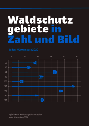
Waldschutzgebiete in Zahl und Bild – Baden-Württemberg 2020
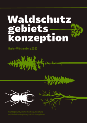
Waldschutzgebietskonzeption Baden-Württemberg 2020
Bedeutung temporär stillgelegter Waldflächen für die Biodiversität. ForstBW intern 4, 6
Referierte Veröffentlichungen
- Seebach, L., Strobl, P., Vogt, P., Mehl, W, San-Miguel-Ayanz,J. (2013). Enhancing post-classification change detection through morphological post-processing. A sensitivity analysis. International Journal of Remote Sensing 34(20), 7145-7162.
- Seebach, L., McCallum, I., Fritz, S., Kindermann, G., Leduc, S., Böttcher, H., Fuss, S. (2012). Choice of forest map has implications for policy analysis: A case study on the EU biofuel target. Environmental Science & Policy 22, 13-24.
- Seebach, L., Strobl, P., San-Miguel-Ayanz, J., Gallego, J., Bastrup-Birk, A. (2011). Comparative analysis of harmonised forest area estimates for European countries. Forestry 84, 285-299.
- Seebach, L., Strobl, P., San-Miguel-Ayanz,J., Bastrup-Birk, A. (2011). Identifying strengths and limitations of pan-European forest cover maps through spatial assessment. International Journal of Geographical Information Sciences 25, 1865-1884.
- Sedano, F., Kempeneers, P., Strobl, P., Kucera, J., Vogt, P., Seebach, L., San-Miguel-Ayanz, J. (2011). A Cloud Mask Methodology for High Resolution Remote Sensing Data combining Information from High and Medium Resolution Optical Sensors. ISPRS Journal of Photogrammetry and Remote Sensing 66, 588-596.
- Kempeneers, P., Sedano, F., Seebach, L., San-Miguel-Ayanz, J. (2011). Data fusion of High and Medium Resolution Remote Sensing images applied to forest type mapping. IEEE Transactions on Geoscience and Remote Sensing 49, 4977-4986.
- Pekkarinen, A., Reithmaier, L., Strobl, P. (2009): Pan-European Forest/Non-Forest mapping with Landsat ETM+ and CORINE Land Cover 2000 data, ISPRS Journal of Photogrammetry and Remote Sensing.64: 171-183
- Reithmaier L., Göckede, M., Knohl, A., Rebmann, C., Churkina, G., Buchmann, N., Foken, T. (2006). Use of remote sensing methods for the characterisation of complex meteorological measurement sites. Theoretical and AppliedClimatology. Vol. 84 (4): 219-233.
Buchveröffentlichungen
San-Miguel-Ayanz, J., McInerney, D., Sedano, F., Strobl, P., Kempeneers, P., Pekkarinen, A., Seebach, L. (2012). Use of wall-to-wall moderate- and high-resolution satellite imagery to monitor forest cover across Europe. In: Global Forest Monitoring from Earth Observation, Achard, F. and M. Hansen (Eds.). CRC Press, 195-211.
Sonstige Veröffentlichungen und Berichte
- Seebach, L., Michiels, H.-G., Braunisch, V. (2020). Naturnähe der Baumartenzusammensetzung im Staatswald Baden-Württemberg räumlich modelliert. Standort.Wald 51, 37-52.
- Seebach, L., Strobl, P., Vogt, P., San-Miguel-Ayanz, J., Kempeneers, P., Sedano, F., Gerrand, A. (2010). Pilot Study in Europe for the Global Forest Remote Sensing Survey. Publications Office of the European Union, Luxembourg, EUR 24488EN.
- Bauerhansl, C., Berger, F., Dorren, L., Duc, P., Ginzler, C., Kleemayr, K., Koch, V., Koukal, T., Mattiuzzi, M., Perzl, F.,Prskawetz, M., Schadauer, K., Schneider, W., Seebach, L., (2010). Development of Harmonized Indicators and Estimation Procedures for Forests with Protective Functions against Natural Hazards in the Alpine Space. Publications Office of theEuropean Union, Luxembourg, 24127 EN: pp. 181.
- Ridder, R., Gerrand, A., Lindquist, E., Wilkie, M., D`Annunzio, R., Achard, F., Beuchle, R., Bodart, C., Brink, A., Eva, H., Kissiyar, O., Mayaux, P., Rasi, R., Stibig, H., Vollmar, M., San-Miguel-Ayanz, J., Kempeneers, P., Sedano, F., Seebach, L., Strobl, P., Vogt, P. (2009). The FRA 2010 Remote Sensing Survey - An Outline of Objectives, Data, Methods and Approach. Rome (Italy): FAO (Food and Agriculture Organization of the UN). JRC56517
- Bastrup-Birk, A., Pekkarinen, A., Reithmaier, L., Kvist Johannsen, V. (2007): Testing of the k-nearest neighbour method to estimate and map forest volume, biomass and cover type in fragmented forests. Proceedings of ForestSat 2007 in Montpellier, France, November 5-7.
- Strobl, P., Reithmaier, L., Soille, P., Mehl, W., Bielski, C. (2007): Assembly of a remote sensed reference image database of Europe at 25m resolution. Proceedings of 27th EARSeL Symposium “Geoinformation in Europe”, Bolzano, Italy, June 4-7.
- Reithmaier, L., Barbosa, P., San-Miguel-Ayanz, J. (2005): Assessment of Quickbird images to monitor early post-fire vegetation dynamics applying spectral mixture analysis. Proceedings of ForestSat 2005, Boras in May 31-June 3: 36-40.
Forschungsschwerpunkte
- wissenschaftliche Analyse von Waldschutzgebieten
- Dynamik von Wäldern mit natürlicher Entwicklung
- Raumanalysen von Waldschutzgebieten, Generierung von Potentialflächen
- Analysen von Waldstrukturen mit Hilfe von Fernerkundung
Fachliche Beratung und Betreuung
- Flächenbilanzierungen und Berichterstattung von Waldschutzgebieten
- Neuausweisung von Waldschutzgebieten
- Verkehrssicherungspflicht u.ä. in Bannwäldern
- allgemeinen Fragen zu Bannwäldern
Weitere Tätigkeiten
- Personalratmitglied seit 2019
- Gutachtertätigkeiten bei der Europäischen Kommission
Lehrtätigkeit
Restauration von Waldökosytemen, Universität Freiburg
Projekte
Aktuell kein Projekt vorhanden.

